|
Reach of Monument Creek that borders the Colorado College campus. North is to right. google.com/maps/@38.8483712,-104.8283321 |
The Good Idea: Monument Creek Phase II, Slowing the Water
This Summer, three Colorado College interns will spend 10 weeks in the field and in the
Geospatial lab, measuring stream morphology and flow, gathering data on the riparian ecosystem, and using science and geospatial data to develop a design for environmental restoration of
Monument Creek.
The project is Phase II of
The Good Idea: Monument Creek, sponsored by Innovation at CC and State of the Rockies. Inspired by the Colorado Springs’ founding principles and Colorado College’s strategic plan, the aim of the project is to create a model framework for the kilometer-long stretch of Monument Creek that forms the western border of campus.
Student interns are:
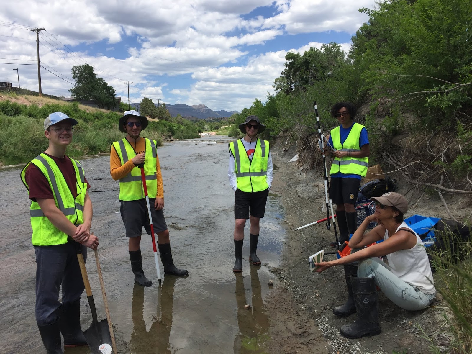
 |
From R to L: David Sachs, Darryl Filmore, Jonny Norwine,
Will Rundquist, Cyndy Hines, and Christine Siddoway. The
chocolate labs (water experts) are Pearl and Bessie. Photo: Mark Lee |
David Sachs, senior, Interdiscipl. Major
Will Rundquist, senior, Geology Major
Darryl Filmore, junior, Comp.Sci. Major
Collaborators/Mentors are :
Interns will gain strong GIS skills, experience in dialog with community stakeholders, and a strong grounding in the fundamentals of Geodesign.
The objective of the summer work is to develop a 3D model design for remediation of the riparian environment along the urban reach of Monument Creek that borders the Colorado College campus. The hope is that the design will provide impetus for joint implementation of measures that will improve streamwater quality, mitigate impacts of floods, aid in education about how riparian environments function/enhance urban environments.
The work is carried out in knowledge of the concerted work / ongoing projects of the
Fountain Creek Watershed District; Colorado Springs
Parks, Recreation, and Cultural Services;
Colorado Springs Utilities; and
Rocky Mountain Field Institute.
Stormwater mitigation and the health of Monument Creek as a part of the Fountain Creek Watershed are an enormous priority for the City of Colorado Springs.
The geospatial database and 3D Geodesign will be used and refined by a larger cadre of students in Block 8, 2019, when CC’s Introduction to
Geodesign course is offered for a third time.
The landscape design models developed in the course will involve conversation and collaboration with community stakeholders, and culminate with models to be shared with campus and city decision makers who have an ability to aid the objective of reintegration of a clean, healthy watercourse into the CC campus and Monument Creek Park.
The project is to be CC’s flagship contribution to
Changing our Global Infrastructure, an international geodesign collaboration among academic instutions.